Map 1: KEY SETTLEMENTS ALONG THE BLACK SEA LITTORAL
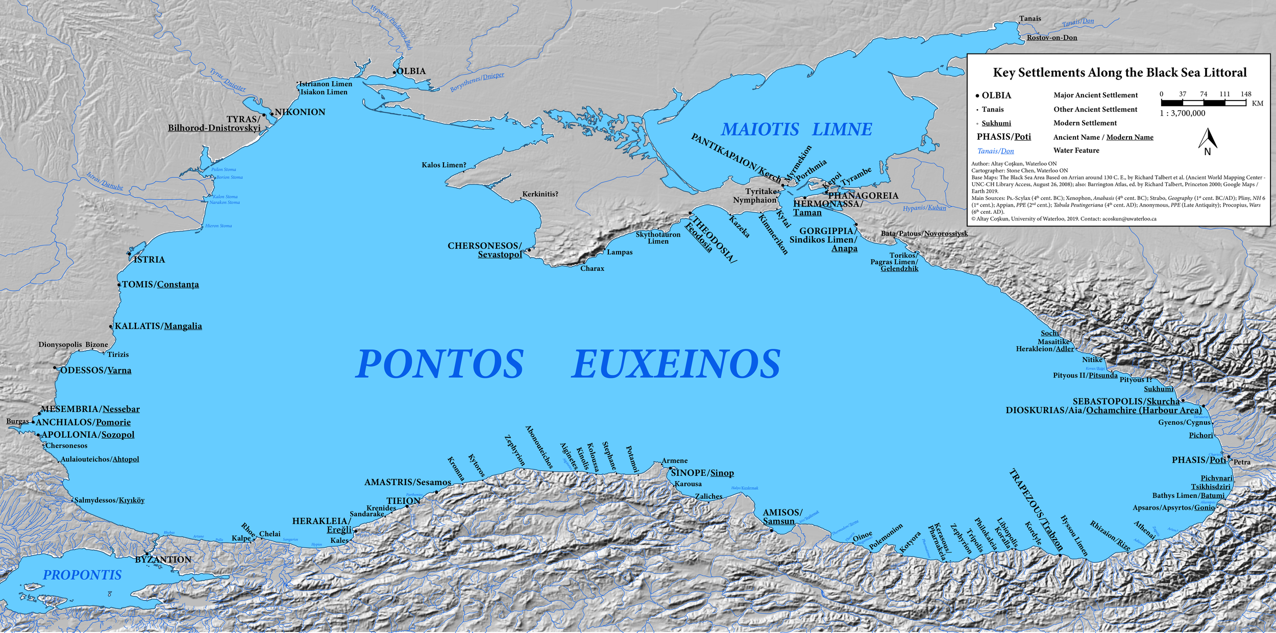
Authors: Altay Coşkun & Stone Chen, Waterloo ON
Cartographer: Stone Chen, Waterloo ON
Base Maps: The Black Sea Area Based on Arrian around 130 C.E., by Richard Talbert et al. (Ancient Mapping Center – UNC-CH Library Controlled Access, August 26, 2008); also: Barrington Atlas, ed. by Richard Talbert, Princeton 2000; Google Maps / Earth 2019.
Main Sources: Ps.-Scylax (4th cent. BC); Xenophon, Anabasis (4th cent. BC); Strabo, Geography (1st cent. BC/AD); Pliny, NH 6 (1st cent.); Appian, PPE (2nd cent.); Tabula Peutingeriana (4th cent. AD); Anonymus, PPE (Late Antiquity); Procopius, Wars (6th cent. AD).
© Altay Coşkun & Stone Chen, University of Waterloo, 2019. Contact: acoskun at uwaterloo.ca
Note: The next revision will also account for the Kuban Bosporus, which ran parallel to the Kimmerian Bosporus, see U. Schlotzhauer et al. 2017, in V.I. Molodin & S. Hansen (eds.), Multidisciplinary Approach to Archaeology: Recent Achievements and Prospects, Novosibirsk, 392–404.